Kit Hill and Gunnislake — History & Photographs
From the mining summit above Callington to the working village beside the Tamar
Kit Hill: the view and the history beneath it
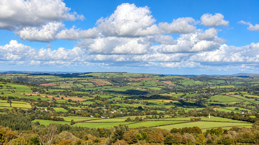
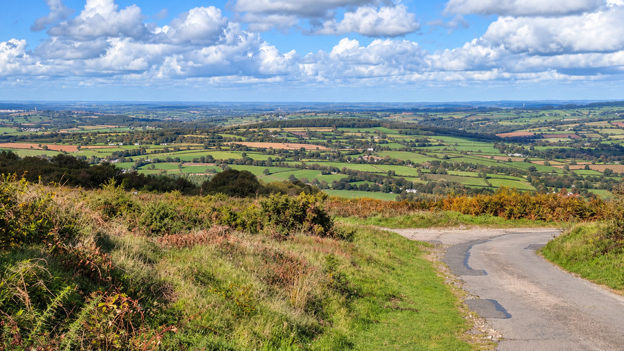
The first three photographs were all taken from Kit Hill, the prominent granite height between Callington and the Tamar. At approximately 334 metres, it commands extensive views across the fields and wooded valleys of east Cornwall, towards Dartmoor and the wider countryside. Its open summit is now a place for recreation, but for centuries it was also a place of labour: people searched its slopes for mineral veins, dug shafts, drained workings, crushed ore and quarried granite.
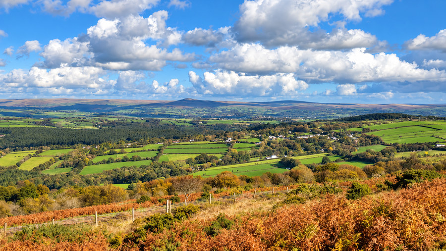
The hill's granite formed when molten rock cooled underground. Mineral-rich fluids later deposited ores along fractures in the rocks, notably tin, copper and tungsten (then commonly called wolfram). Tin extraction is recorded from at least medieval times. Early workers collected weathered tin-bearing stones, known as shode, and dug shallow pits or used water to separate valuable material from waste. Later workings followed mineral lodes underground, and by the eighteenth and nineteenth centuries miners needed deeper shafts, drainage adits and increasingly powerful machinery.
Steam engines, shafts and the 1858 chimney
Industrial mining left its clearest marks during the nineteenth century. Kit Hill United was active in the mid-1800s, and South Kit Hill Mine opened in 1856, eventually reaching a depth of more than 100 metres. The North Engine Shaft exceeds 200 metres. The distinctive summit chimney was erected in 1858 for the Kit Hill Great Consols/Kit Hill United complex. It formed part of the steam-powered installations associated with pumping, winding and ore treatment. Historic England notes that the chimney was deliberately designed as a conspicuous monumental column, at the Duchy of Cornwall's insistence.
The mining industry was rarely secure. Hard granite, expensive drainage and fluctuating metal prices could turn a promising venture into a loss. Kit Hill United closed in 1864 after trouble with its machinery; other workings continued intermittently into the later nineteenth century. Tin, copper and tungsten were all sought, and tungsten attracted renewed interest during the First World War because of its industrial and military uses. Mining did not leave a single tidy monument: its legacy is a scatter of shafts, spoil, buildings, tracks and altered ground across the hillside.
From steam power to mobile communications
The ornamental summit chimney, erected in 1858 for the Kit Hill Great Consols mining complex, was not merely a picturesque landmark. Its flue carried away smoke from boilers supplying steam power for mining machinery. Historic England records that the Duchy of Cornwall insisted on a monumental design appropriate to such a conspicuous site. The chimney stands within the remains of an eighteenth-century folly associated with Sir John Call, who acquired the nearby Whiteford estate in 1763. Thus even the summit combines successive uses: commemoration, industry and, today, communication.
The chimney is now conspicuously equipped with aerials, including equipment serving mobile-phone networks. A high summit offers wide radio coverage because fewer intervening hills obstruct signals. Mobile communications depend on electronic transmitters and receivers rather than steam engines, but the principle of exploiting this commanding height remains. The aerials are a visible modern addition to the historic structure; I have found no reliable published date for their first installation or a complete list of operators, so neither should be asserted as fact.
Granite quarrying and a public landscape
Mining was not the only extractive industry. Granite was first gathered as loose surface stone and later quarried directly from the bedrock. Industrial quarries developed on the northern slopes; the larger south-eastern quarry closed in 1955. The hill also contains older archaeological remains, including prehistoric features and an earthwork folly constructed around 1780 by Sir John Call, who intended it as the site of his tomb. The plan was never carried out.
In 1985 Kit Hill was given to Cornwall Council on behalf of the people of Cornwall to celebrate the birth of Prince William. Its roughly 152 hectares became a country park. In 2006 the historic mining landscapes of Cornwall and west Devon received UNESCO World Heritage status, recognising the international significance of the region's industrial development. The summit is therefore both a viewpoint and an open-air record of the people who worked here.
Gunnislake: from mining village to community art
Gunnislake's fortunes were closely connected with the mines of the Tamar Valley. During the eighteenth and nineteenth centuries the wider Calstock and Gunnislake district was an important centre of copper mining, with tin and other minerals also worked. Mines provided jobs underground and above ground, while local roads, river transport and later railways carried people, supplies and produce. The village's steep streets and closely packed buildings reflect a settlement shaped by both its terrain and its industrial economy.
Rosie Fierek and the ceramic mural
The ceramic mural photographed at the Gunnislake traffic lights is Wheal Talk, a work by Rosie Fierek, the Albaston-based artist whose other public works include the Albaston Welcome Tree, the Tavistock Charter Tree and Saltash Fisher Folk (2009). The Gunnislake project grew from a wish to represent the area's mining history while involving present-day residents in making a permanent work of art.
In a proposal considered by Calstock Parish Council on 9 August 2017, Fierek envisaged a mine building formed from ceramic 'granite' blocks, with ivy suggesting nature reclaiming the industrial landscape. Local people would make tiles and impress words of their choosing: names, memories, occupations, landmarks and expressions connected with Gunnislake. The proposal also envisaged a bal maiden and a modern child in conversation, representing a dialogue between past and present. The photographed portion shows the mine-building form and its many individually worded tiles; it is not necessary to assume that every element of the original proposal appears in this photograph.
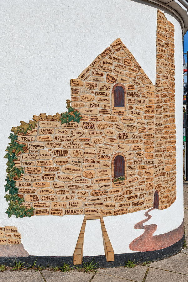
That approach gives the mural a significance beyond decoration. Instead of recording only mine owners, dates and output figures, it lets the community describe itself. It joins industrial memory to the words of living residents. Fierek later led a related project at Gunnislake railway station: its new tiles were unveiled on 6 June 2019, with contributions from children at Delaware and Gunnislake primary schools and other local people. That station project celebrated the railway, market gardening, wildlife and mining; it was a separate installation, not the mural pictured here.
William the Miner: the people behind the industry
The seated figure known as William the Miner offers a different kind of memorial. It was already in place by 2 July 2009, when Roger Cornfoot photographed it. I have not found dependable evidence identifying its sculptor, precise installation date or commissioning body. Its evident commemorative subject is the ordinary miner, rather than a named mine proprietor; it should not be assigned an invented artist or unveiling year. Unlike a mine chimney or an engine house, the sculpture draws attention to an individual worker: his clothes, his posture and the physical demands of his occupation. Underground mining involved darkness, dust, water, dangerous machinery and the continual risk of injury. At the surface, women and children also worked in ore processing and related industries. The image reminds us that the district's industrial achievement rested on human labour, not merely machinery and mineral wealth.

Gunnislake's commercial street: a village built by industry
Commercial Street did not acquire its name by accident. A detailed historic-settlement assessment traces how Gunnislake grew during the nineteenth-century mining boom. Earlier settlement followed lanes through Dimson towards the river and the mineral lodes. Between 1842 and 1882, new workers' cottages and businesses increasingly filled the narrow route towards New Bridge. Commercial Street became the village's principal shopping and social axis, with an unusually dense, almost urban arrangement of buildings for a rural settlement.
The businesses depended on more than tin and copper miners. Gunnislake was also a quarrying village, with granite workers, builders, transport workers, traders and their families supporting local shops. The study records more than 400 workers at Drakewalls and another 400 at Hingston Down at the beginning of that period, alongside smaller operations. Nearby Gunnislake Clitters produced substantial quantities of copper ore between 1860 and 1890. When copper prices fell in the 1860s, some mines closed while others turned towards tin and arsenic, forcing the local economy to adapt.
Today's Pete & Di's Bazaar occupies this inherited street pattern. The small premises, buildings close to the carriageway and tightly enclosed bend tell us something about a place shaped before motor traffic became dominant. The shop is evidence of continuing small-scale commerce, not proof that its particular business has existed since Victorian times. What survives is the form of a street where people once walked between home, work, shops, chapels and public houses, and where everyday conversation was part of village life.
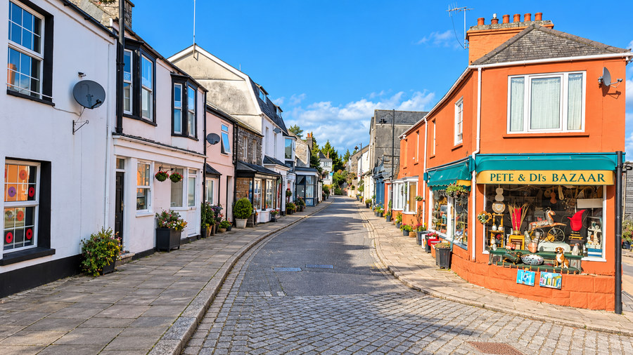
These six photographs therefore link two histories. From Kit Hill, we see the land from which generations extracted wealth, at considerable human cost. In Gunnislake, public art and the surviving street scene show how a community remembers that past while continuing to make a life of its own.
Sources and further reading
Cornwall Council: Kit Hill Country Park — mining, quarrying, prehistoric remains and the 1985 gift; Historic England: Folly on Kit Hill — Sir John Call's folly and the monumental 1858 chimney; J. H. Luxton: Kit Hill Mine photographs — historic mining structures and modern aerials.
Rosie Fierek: Public works — the artist's account of her community projects; Cornish Times: Fierek's ceramic murals — identifies Wheal Talk at Gunnislake's traffic lights; Devon & Cornwall Rail Partnership: Gunnislake tiles — the separate railway-station project unveiled on 6 June 2019.
Geograph: sculpture of a miner, 2 July 2009 — dated photographic evidence of William; Cornwall historic-settlement assessment of Gunnislake (PDF) — the development of Commercial Street and the village's mining economy; Historic England: Gunnislake Clitters Mine — detailed chronology and surviving industrial remains; Visit Tamar Valley: Mining Heritage — the wider mining and transport economy.