Cawsand — History & Photographs
The Tamar crossing, Plymouth, Maker Heights and the Rame Peninsula
The Torpoint ferry: a river crossing and a naval city
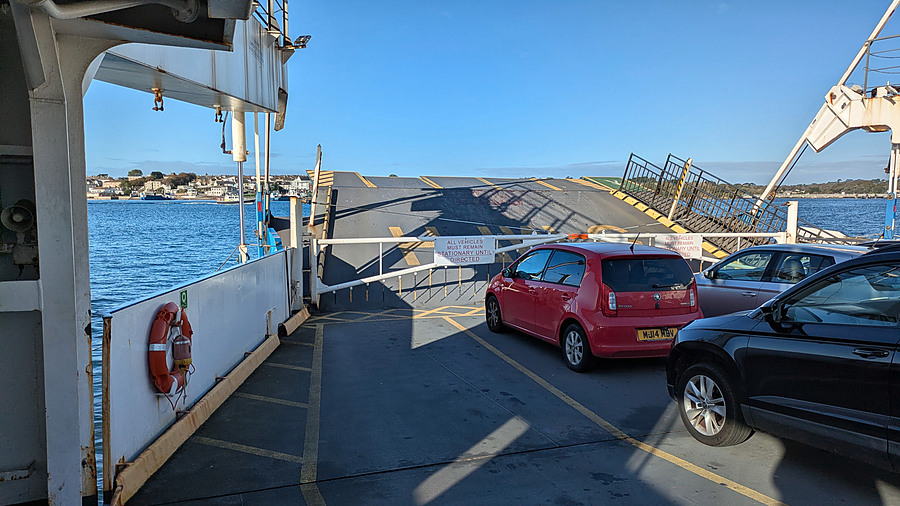
The crossing from Devonport to Torpoint introduces the central theme of this ride: the Rame Peninsula cannot be understood separately from Plymouth. The Tamar is a county boundary, but for centuries its ferries have joined the people, markets and workplaces on either bank. The modern chain ferries are particularly important for the south-western approaches to Plymouth, even after the Tamar Bridge opened in 1961.
Plymouth began not as a naval dockyard but as a settlement around Sutton, recorded in the Domesday Book of 1086. Its harbour at the mouth of the Plym grew into a medieval port. By the late sixteenth century it was a base for ocean-going voyages, privateering and naval operations; Drake's circumnavigation began in 1577, and Plymouth was a principal English naval assembly point during the Armada campaign of 1588. The Royal Citadel was constructed from the 1660s to command the Sound and the town.
The decisive transformation came with the establishment of the Royal Dockyard on the Hamoaze in the 1690s. Shipbuilding, repairs, victualling and naval administration generated the separate town of Dock (later Devonport) and employment for thousands. Plymouth, Stonehouse and Devonport were united administratively in 1914, and Plymouth became a city in 1928. As the ferry heads towards Torpoint, the crossing offers a reminder of the naval-industrial landscape developed around Plymouth and Devonport over more than three centuries.
The waterside road: the C2C route and tidal creeks
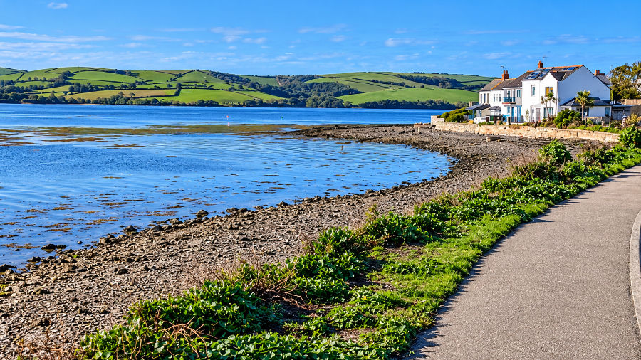
The road west from Torpoint follows an estuarine landscape quite different from the open coast. The sheltered tidal waters and muddy margins once accommodated small boats and local cargoes at places where road journeys were slow. Boats carried people, farm produce and supplies between communities around the Tamar and Plymouth Sound. The surviving creeks show why water transport remained valuable for so long.
These inlets also have an ecological history: salt water reaches far inland at high tide, leaving exposed mud at low water. The route makes visible the relationship between the working estuary and the farms, villages and military installations on its shores.
Millbrook: a settlement at the head of an inlet
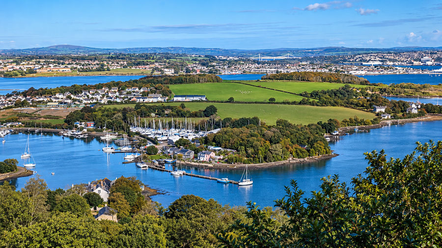
Millbrook developed at the head of a tidal creek, with a small hinterland of farms and lanes. Its waterside position supported fishing, boat work and the exchange of goods with Plymouth, while the inland approach connected it to the villages of the peninsula. Millbrook Lake is tidal; it should not be confused with a large inland freshwater lake.
The Tamar Bridge, visible in the distance, opened in 1961 to provide a fixed road crossing near Saltash. It complemented rather than replaced the Torpoint ferry. This photograph brings two centuries of changing transport priorities into one view: local tidal navigation, ferries and the modern motor-road crossing.
Cawsand and Kingsand: fishing, shipping and smuggling
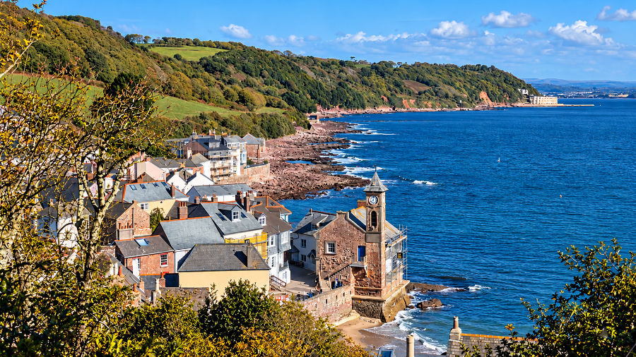
Cawsand is first recorded by name in 1404, but a dated first reference is not the same as a foundation date: settlement and maritime activity may have begun earlier. Its sheltered beach and proximity to the western entrance of Plymouth Sound made it a useful place for fishermen, pilots, sailors and the small boats that supplied anchored ships. Fishing was important, but Cawsand was never simply a picturesque fishing village. In the eighteenth century the provisioning of vessels in Cawsand Bay and smuggling contributed substantially to its economy.
Local church history records a period of prosperity around 1750, when substantial houses were built rather than only modest cottages. High import duties encouraged illicit trade in spirits, tobacco and other goods; its secluded landing places made the peninsula attractive to smugglers. Narrow streets, stores and houses grew around a working waterfront, not around the needs of motor traffic.
Although Kingsand and Cawsand now seem a single settlement, their administrative history was different. Kingsand was in Devon and in the parish of Maker, while Cawsand belonged to Cornwall and the parish of Rame. Kingsand was transferred to Cornwall in 1844. Cawsand's expanding population eventually gained a more conveniently placed Anglican church, St Andrew's, opened in 1878, rather than relying entirely on the remote parish church of St Germanus.
The war memorial, the guns and Cawsand Fort
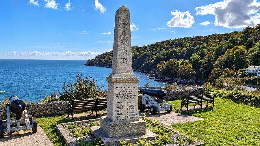
The memorial overlooks the anchorage and commemorates men of Rame who died in the two world wars. Nearby, two guns point seawards. They recall the long history of coastal artillery guarding the approach to Plymouth, but their precise manufacture, original emplacement and date of installation at the memorial have not yet been established. It would be misleading to identify them as guns from a particular fort without further evidence.
The setting is nevertheless historically significant. A battery was established at Cawsand in 1779. A much larger fort was constructed from 1860, following an 1858 recommendation that the bay be defended against hostile ships. Historic England records completion in parliamentary reports by 1863, although a War Department boundary stone bears the date 1867. Its defences included substantial walls, magazines and gun positions; the fort ceased military use in 1926 and was later converted into private residences.
The war memorial also belongs to Plymouth's wider wartime story. The naval dockyard and city were major targets during the Second World War. Plymouth City Council records 59 air raids between July 1940 and April 1944, with the worst attacks in March and April 1941. Some 1,174 civilians died, 3,754 homes were destroyed and 18,389 more required major repairs. The destruction of streets, schools, churches and shops left a legacy that would shape the post-war childhoods of those who later visited Maker Camp.
Cawsand Bay, Plymouth Sound and the breakwater
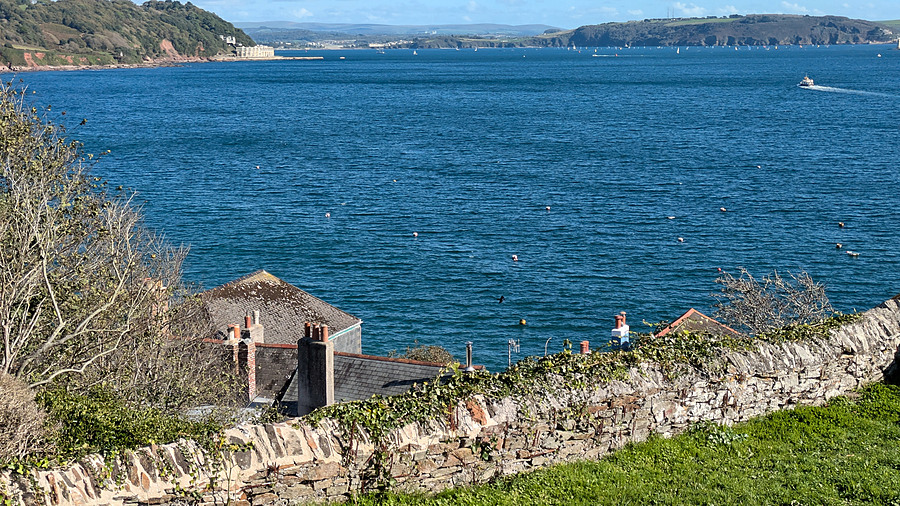
The view across Cawsand Bay explains both its value and its vulnerability. Sailing ships could wait at anchor here, sheltered from some winds and close to Plymouth Sound, but an enemy fleet or landing force might use the same waters. During the American War of Independence a combined French and Spanish fleet threatened Plymouth in August 1779. The possibility that troops could land on the Cornish shore and occupy Maker Heights helped drive a new system of defences.
The immense Plymouth Breakwater was another response to the needs of a naval port. Begun in 1811–12 to designs associated with John Rennie, and substantially completed in 1841, it stretches more than 5,000 feet (about 1.5 km) across the entrance to Plymouth Sound. Approximately 4.5 million tons of stone were used. The barrier reduced the force of waves entering the anchorage, making it safer for naval vessels and commercial shipping to lie in the Sound in rough weather. It did not make the approaches hazard-free, but it was one of the great marine-engineering undertakings of the nineteenth century.
Beyond the Sound lies the Eddystone reef, about 14 miles south of Plymouth, notorious for wrecks. Henry Winstanley's first lighthouse was completed in 1698 and was lost in the Great Storm of 1703. John Rudyerd's successor was destroyed by fire in 1755. John Smeaton's revolutionary granite tower, completed in 1759, used interlocking masonry and a curved profile to withstand the sea; its upper section now stands on Plymouth Hoe. The present lighthouse, built by James Douglass, entered service in 1882. The light warns shipping away from the dangerous rocks and has been vital to the safe approach to Plymouth and the Channel routes.
Maker Heights: from coastal defence to children’s holidays
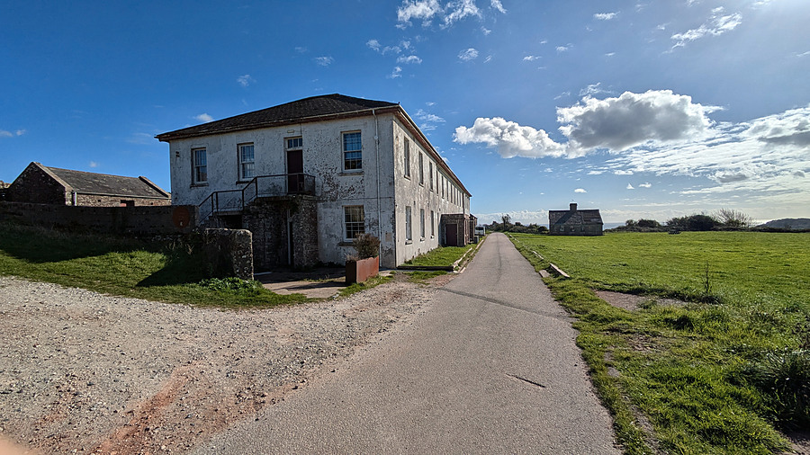
Maker Heights dominates the approaches to the Sound. Five redoubts were begun from 1779 to prevent hostile forces occupying ground from which they could threaten Devonport Dockyard. The barrack block was probably built between 1784 and 1787 to accommodate about 335 soldiers and 50 horses. These works were part of a defensive landscape repeatedly adapted during the nineteenth and twentieth centuries, including later gun batteries and anti-aircraft installations.
Yet Maker has another history that matters at least as much to generations of Plymouth residents. In 1923 Maker Camp began providing seaside holidays for children and young people, initially supported by the Virginia House Settlement. It subsequently received local education authority support, with family contributions assessed according to means. For children from crowded streets and families with little spare money, a week at Maker could be their only holiday.
After the bombing of Plymouth, its value was especially evident. Former campers remember the grass, the space, the walk to the beaches, school parties, dormitories and Nissen huts. One recalled that the playground at home had been bombsites; another described travelling from Cremyll in green double-decker buses, with luggage carried separately. The camp continued into the mid-1980s. Its significance was social and educational: outdoor activities, shared responsibilities, friendships and an experience of countryside and coast otherwise inaccessible to many children.
Today the military barrack block is owned by the Rame Conservation Trust and houses creative studios and related enterprises. The wider Maker Heights site includes a campsite, café, music and arts activities, and other small businesses; conservation of the historic buildings remains an ongoing challenge. The site has changed from a defence installation to a place of public recreation and creative work, while retaining memories of the school holidays that linked it to Plymouth's post-war communities.
The abandoned building opposite the barracks
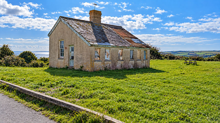
The boarded windows, damaged roof and isolated position of this building make it a conspicuous part of the Maker landscape. Its proximity to the barracks suggests a possible military or later camp-related use, but neither its construction date nor its original purpose has been securely identified. Maker Heights once included auxiliary buildings as well as the main barrack block, but proximity alone is insufficient to assign this particular structure a function.
For the present it is best treated as an unidentified historic building requiring documentary research. Its condition also illustrates the difficulty of maintaining redundant buildings when the activities for which they were constructed have disappeared.
St Germanus at Rame: a church of rough slate and an extensive churchyard
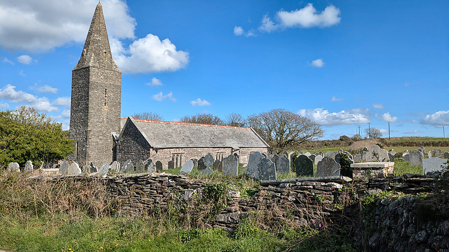
The isolated parish church of St Germanus is remarkable both for its architecture and for the number of graves surrounding it. The church is not made of neatly dressed ashlar: Historic England describes its walls as slatestone rubble with granite dressings . The rough local stone gives the building its distinctive appearance, while the slender, unbuttressed tower and broached spire are unusual in Cornwall.
The present church was consecrated on 15 October 1259 by Walter de Bronescombe, Bishop of Exeter, although a reused Norman carved stone indicates an earlier church. Further work followed in 1321 and the late fifteenth century, including the south aisle; restorations took place in the nineteenth century. The church retains medieval and early-modern furnishings and memorials, and still has no mains electricity, with services traditionally lit by candles.
Its apparent remoteness is misleading. It was the parish church for a dispersed rural community and for Cawsand before the opening of St Andrew's in 1878. The many gravestones are evidence of successive generations of parishioners, not proof that a large village once stood immediately beside it. Historic England lists individual eighteenth-century memorials, while the Church of England records that the churchyard was closed for burial by an order dated 22 May 1883. The graveyard therefore preserves a substantial record of local families and maritime and agricultural life.
Rame also provides a direct connection with Dartmoor. Land at Rame was associated with Tavistock Abbey before the Norman Conquest, and the Domesday survey of 1086 records the locality. The coastal parish and the inland monastic estate were part of the same medieval world of landownership, rents and religious authority.
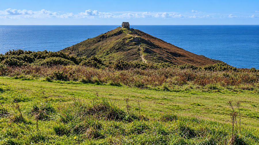
Rame Head: prehistoric fort, St Michael’s Chapel and wartime radar
The small stone edifice on the summit is the medieval Chapel of St Michael , not the parish church of St Germanus. Historic England describes it as a simple rectangular building of slatestone and granite rubble, with a stone-vaulted roof and unglazed openings. Mass was licensed there in 1397. Its dramatic position made it a place of local devotion and pilgrimage as well as a landmark visible from the sea.
Rame Head had a strategic role long before the chapel. Earthworks on the narrow neck of the headland survive from a promontory fort, generally associated with later prehistory. In 1486 Plymouth was paying for a watchman and beacon at Rame to signal approaching vessels. The headland served again as a lookout during the Armada crisis of 1588.
During the Second World War the headland became part of the radar and anti-aircraft warning system guarding Plymouth. Remains of a radar station and wartime defensive works survive near the chapel. Thus the same commanding position served prehistoric defence, medieval worship, maritime signalling and twentieth-century electronic surveillance.
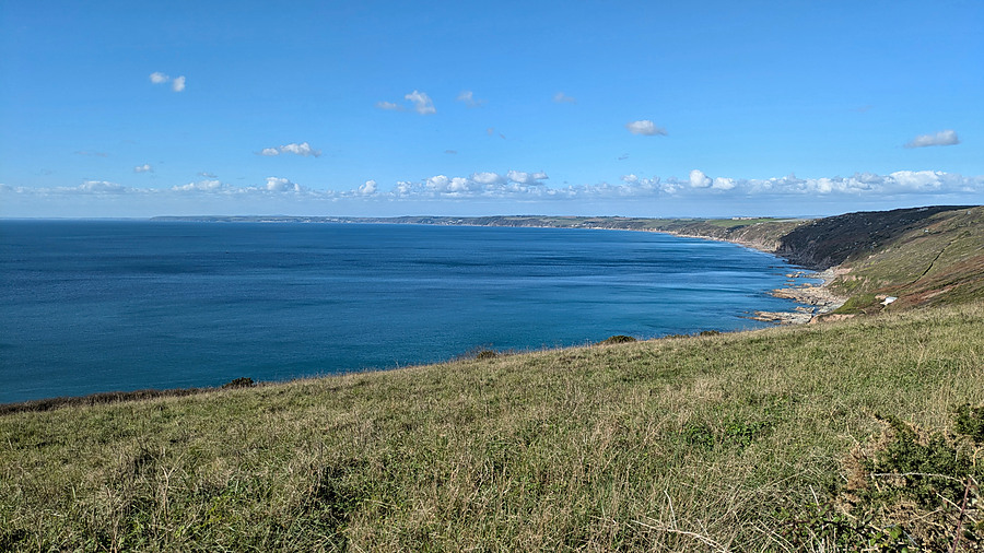
Whitsand Bay: an exposed coast with a military past
West of Rame Head, Whitsand Bay is a striking contrast to the sheltered anchorage at Cawsand. The long beaches and cliffs face the open Channel, and rough seas have always made this a less forgiving coast. Above the cliffs, farms and grazing land formed part of the peninsula's rural economy.
The headlands were also valuable to coastal artillery. Whitsand Bay Battery, on the ridge above Tregonhawke Cliff, was constructed in 1888–90, armed in 1893 and modified as defensive requirements changed. A radar station was installed around 1942. After release by the Ministry of Defence in 1951, the site became a holiday park from 1955. This is another example of military land finding a recreational purpose in the post-war decades.
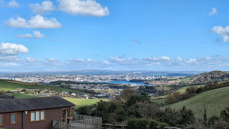
Plymouth seen from the Cornish coast
The final view towards Plymouth brings together the history of the ride. From the medieval harbour at Sutton to the dockyard developed on the Hamoaze in the 1690s, the city grew because it offered access to sheltered water and strategic sea routes. Its importance brought wealth and employment, but also repeated concern about invasion, coastal fortification and, in 1940–41, devastating aerial bombardment.
The Rame Peninsula supplied anchorage, defensive high ground, fishing communities and, later, countryside holidays for children from the city. The breakwater and Eddystone Lighthouse show how engineering reduced the dangers of the sea; Maker and Rame show how military technology responded to dangers from human enemies. The peninsula was never an isolated corner of Cornwall. Its history was intimately bound to Plymouth and the wider Tamar estuary.
Connections with the Tamar Valley and Dartmoor
Rame is the coastal end of the same connected landscape explored elsewhere in Out & About. Tavistock Abbey's medieval interests reached the peninsula; the Tamar linked inland produce and settlements with the sea; Devonport Dockyard drew labour and supplies from both banks; and Plymouth's naval importance dictated fortifications on the Cornish heights. Maker Camp adds a twentieth-century connection between Plymouth's working families and the countryside. The photographs are therefore not simply a record of a scenic ride: they illustrate changing relations between coast, valley, city and moor.
Sources and further reading
The principal sources used for dates and specific historical details are Visit Plymouth: Plymouth's History ; Plymouth City Council: The Blitz ; Maker Heights: Maker Camp memories ; Maker Heights: Barrack Block ; Historic England: Cawsand Fort ; Historic England: St Germanus Church ; Church of England: St Germanus churchyard ; Historic England: Rame Head ; Historic England: Plymouth Breakwater ; IALA: Eddystone Lighthouse ; and Historic England: Whitsand Bay Battery . The original provenance of the two cannons by the memorial and the function of the derelict building opposite Maker Barracks remain unverified.