Dozmary Pool and St Cleer — History & Photographs
From the early medieval stones of Doniert to Bodmin Moor, the Fowey valley and St Cleer
Across the countryside towards St Cleer
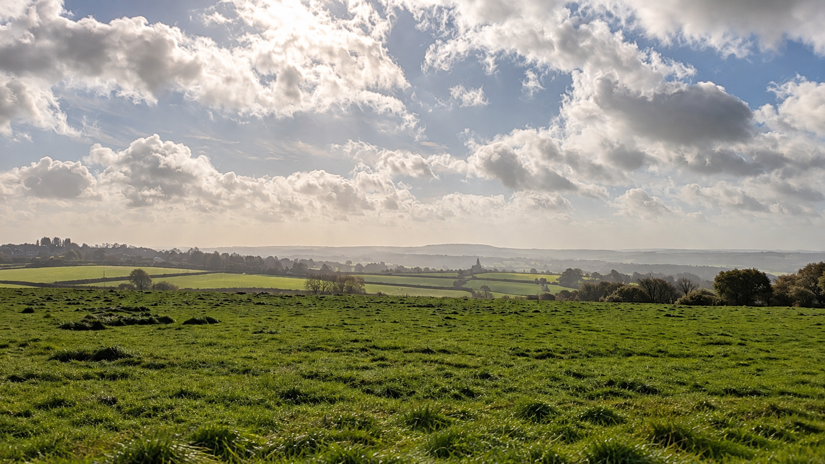
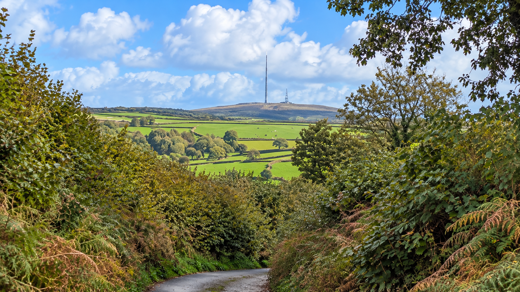
The approach towards St Cleer crosses the southern fringe of Bodmin Moor, a landscape in which farmland, prehistoric remains, medieval crosses and former mining settlements exist within a few miles of one another. The lanes are more than a way of reaching the pool: they connect places whose histories extend from the earliest farming communities to modern broadcasting.
Doniert’s Stone
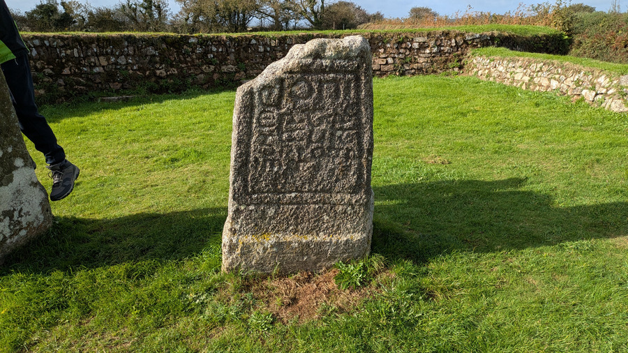
Two fragments of ninth-century stone crosses stand together at King Doniert’s Stone. The smaller, northern fragment bears the Latin inscription Doniert rogavit pro anima—a request made by Doniert for the sake of his soul. It is generally associated with Dungarth (or Dumgarth), a ruler of Dumnonia recorded as having drowned around AD 875. The identification is plausible, not absolutely certain.
The inscription is exceptionally valuable: Historic England describes it as one of only two inscribed stones naming a Cornish king, and the only one referring to a ruler also known from written records. It offers a rare link between a named person and Cornwall’s early medieval material culture.
A cyclist among the stones
The taller southern stone, sometimes called the “Other Half Stone”, is about 2.1 metres high and carries interlace carving. Despite the popular name, the two fragments are not securely established as pieces of the same cross. Excavation also revealed a rock-cut passage ending in a cross-shaped chamber beneath the stones. Its purpose, and its connection with the monuments above, remain unexplained.

Dozmary Pool
The legend of Jan Tregeagle begins not at the pool but with a dishonest Cornish steward and magistrate. In one traditional account, a dispute over money was brought before a court after his death. When someone demanded that Tregeagle himself testify, his ghost appeared and gave evidence. Having summoned him, however, the living could not dismiss him. Clergymen therefore set him an apparently endless task: to empty the supposedly bottomless Dozmary Pool using a limpet shell with a hole in it. As long as he kept working, the Devil's hounds could not claim him. The story was collected in the nineteenth century by Robert Hunt; it is folklore, not a record of an actual haunting.
The irony is that the supposedly bottomless pool is exceptionally shallow. The UK Centre for Ecology & Hydrology gives an average depth of just 0.4 metres (about 16 inches) and a maximum depth of 0.6 metres (approximately two feet), although historical accounts have described greater depths. Its catchment is linked with the wider Cornish water environment, including the Colliford Lake safeguard zone. During the ride, an Environment Agency worker explained that water samples are taken regularly because Dozmary Pool forms part of the monitored water system. The worker said that more than forty minerals or other substances are found in its water, including heavy metals such as cadmium and mercury. That figure is reported here as the worker’s account, not as an independently verified laboratory inventory. The Environment Agency’s published classification supports the importance of monitoring: its 2019 assessment rated cadmium and its compounds “Good”, but mercury and its compounds “Fail”. These classifications concern environmental standards; they do not by themselves establish that the water is unsafe to drink, nor do they specify the concentration of each substance.
The open moor
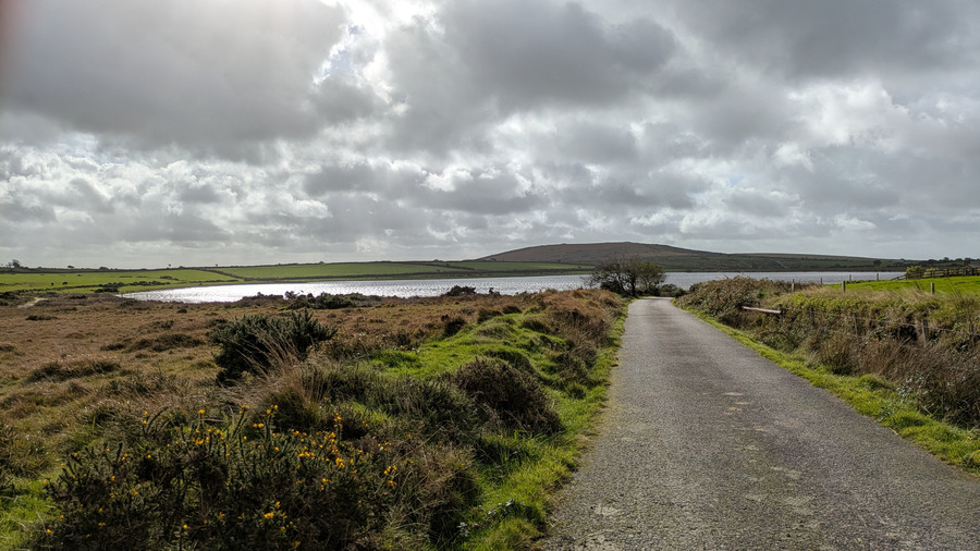
The view towards Brown Gelly shows the wide, comparatively treeless moorland around Dozmary Pool. Although it can appear almost empty, Bodmin Moor has been shaped by centuries of grazing, settlement and changing land use. The farm and the pool belong to that working landscape, not to an untouched wilderness.
Colliford Lake
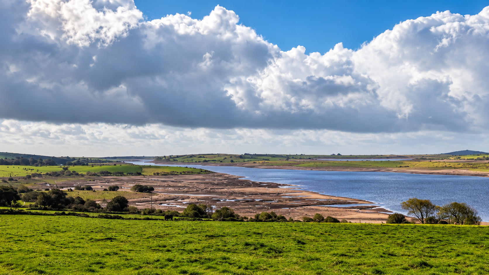
Colliford was created by damming the River St Neot in 1983–84, at a time when Cornwall needed greater security of supply for residents, industry and the summer tourist population. Covering roughly 900 acres, it is Cornwall's largest reservoir. Its stored water forms part of a wider network of reservoirs, river abstractions and treatment works used to balance demand across Cornwall; it is not simply a lake serving the neighbouring villages.
The strikingly exposed banks in the photograph are therefore more than a seasonal curiosity. They show how prolonged dry weather can reduce the reserves on which households and businesses depend. Dozmary Pool drains into this reservoir system, making the juxtaposition of the natural pool and the engineered lake especially revealing.
Treverbyn Mill
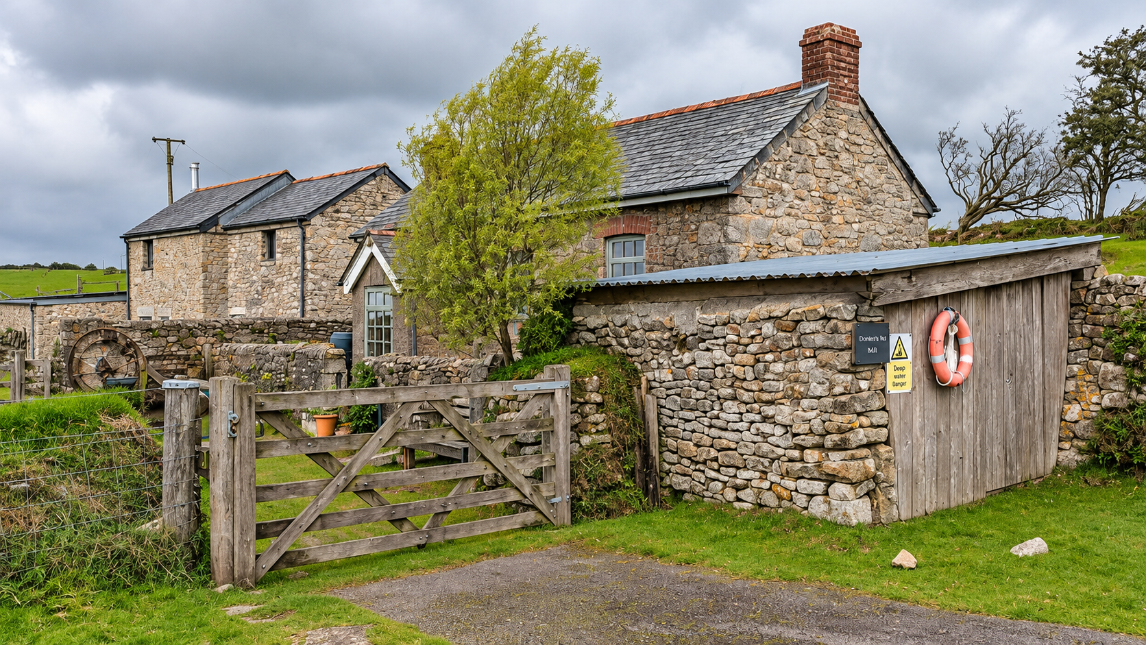
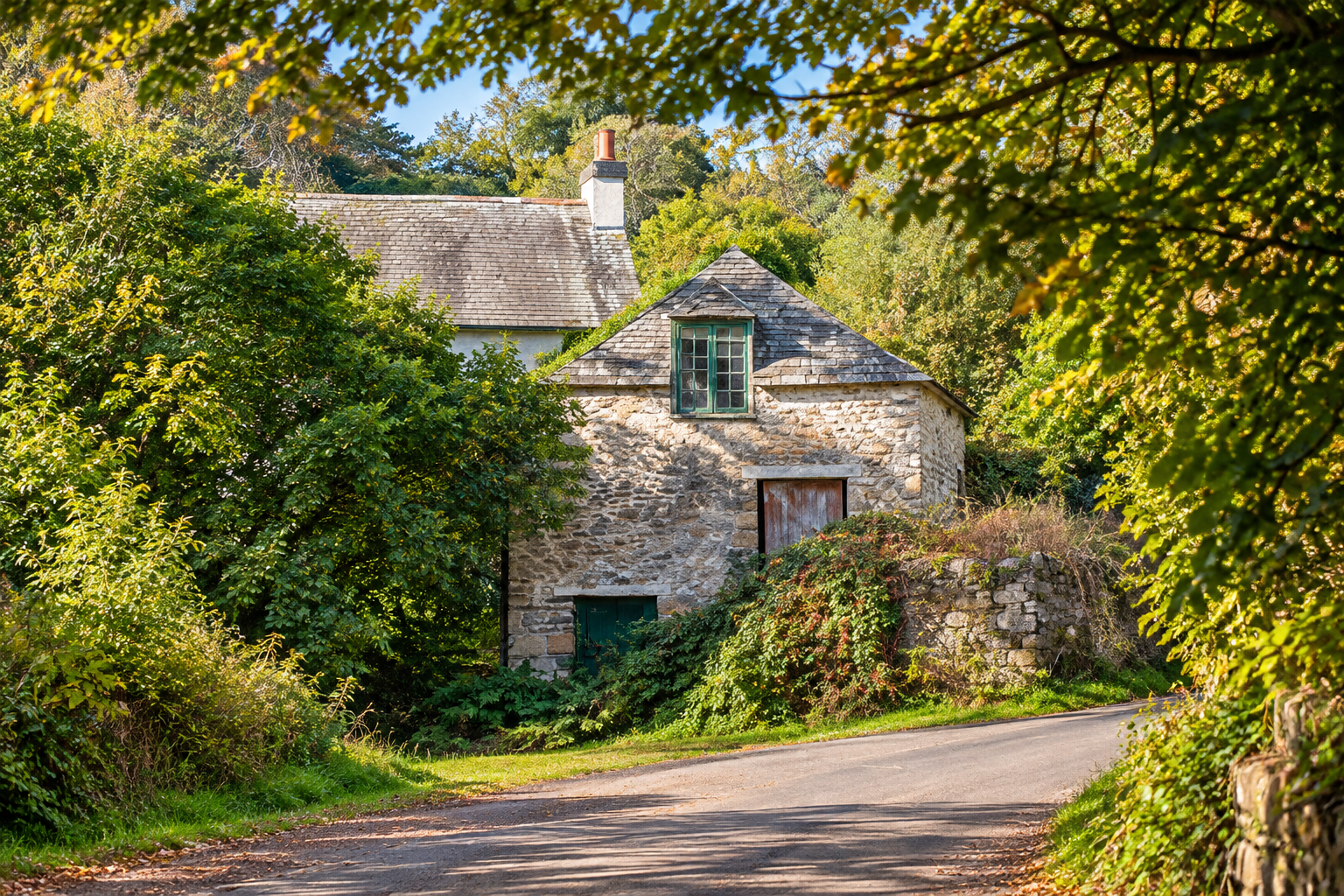
Historic England identifies Treverbyn Mill as probably eighteenth-century, with a nineteenth-century extension. It was a three-storey watermill driven by an overshot wheel: water carried along a wooden launder fell onto the wheel from above, transmitting power through gearing to millstones on an upper floor.
Its work changed with agricultural demand. When the building was listed in 1987, it was still being used to grind cattle feed, with a hopper feeding a mixer. The original millstones had already been removed. I have not found reliable evidence for the date when commercial milling finally ceased, so it would be wrong to invent one.
The River Fowey
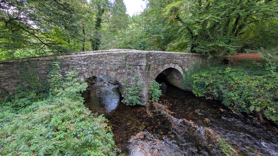
The old stone bridge in the photograph is no longer used by through traffic. The modern lane follows a lower alignment, avoiding the much steeper ascent that continued beyond the former crossing. Together the abandoned bridge and the newer road illustrate how even minor rural routes have been altered to accommodate changing transport needs.
The River Fowey flows through the wooded country below the moor. A bridge here carries the road across the water that helped support the local milling economy. Its setting marks a striking change from the exposed country around Dozmary Pool: enclosed woodland, a working river and narrow roads shaped by the valley.
A wayside cross at Fursnewth
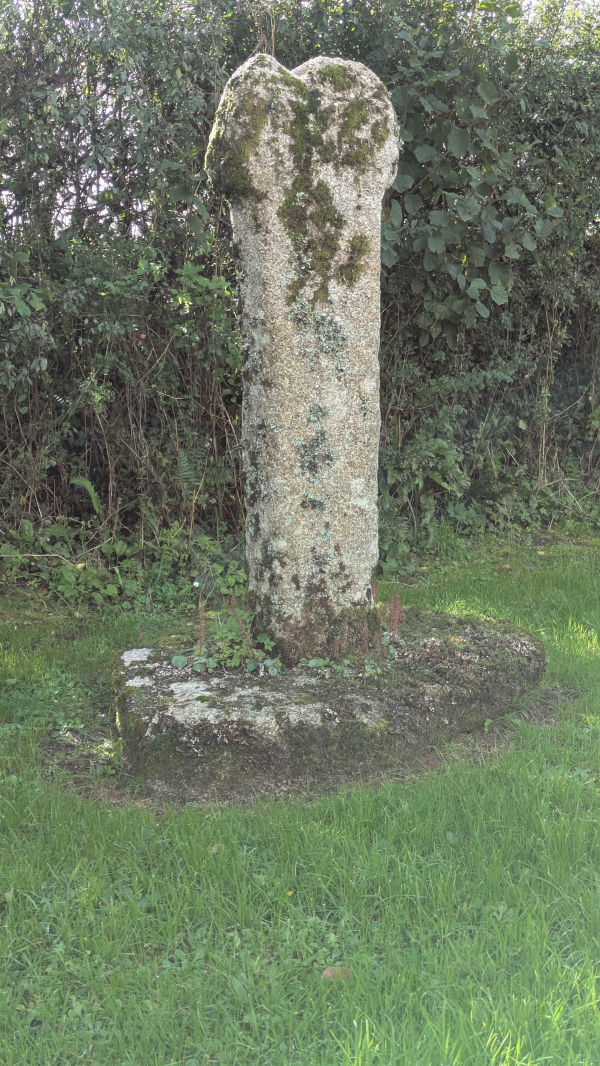
This is a medieval Grade II* listed wayside cross, approximately 1.68 metres high, retaining traces of its carved cross. It did not remain continuously in its original setting: it was moved from Fursnewth to Pendean House near Liskeard, then restored and returned in 2013. Its present position is therefore the outcome of deliberate local conservation, not merely centuries of undisturbed survival. The recorded grid reference is SX 2253 6744.
St Cleer parish church
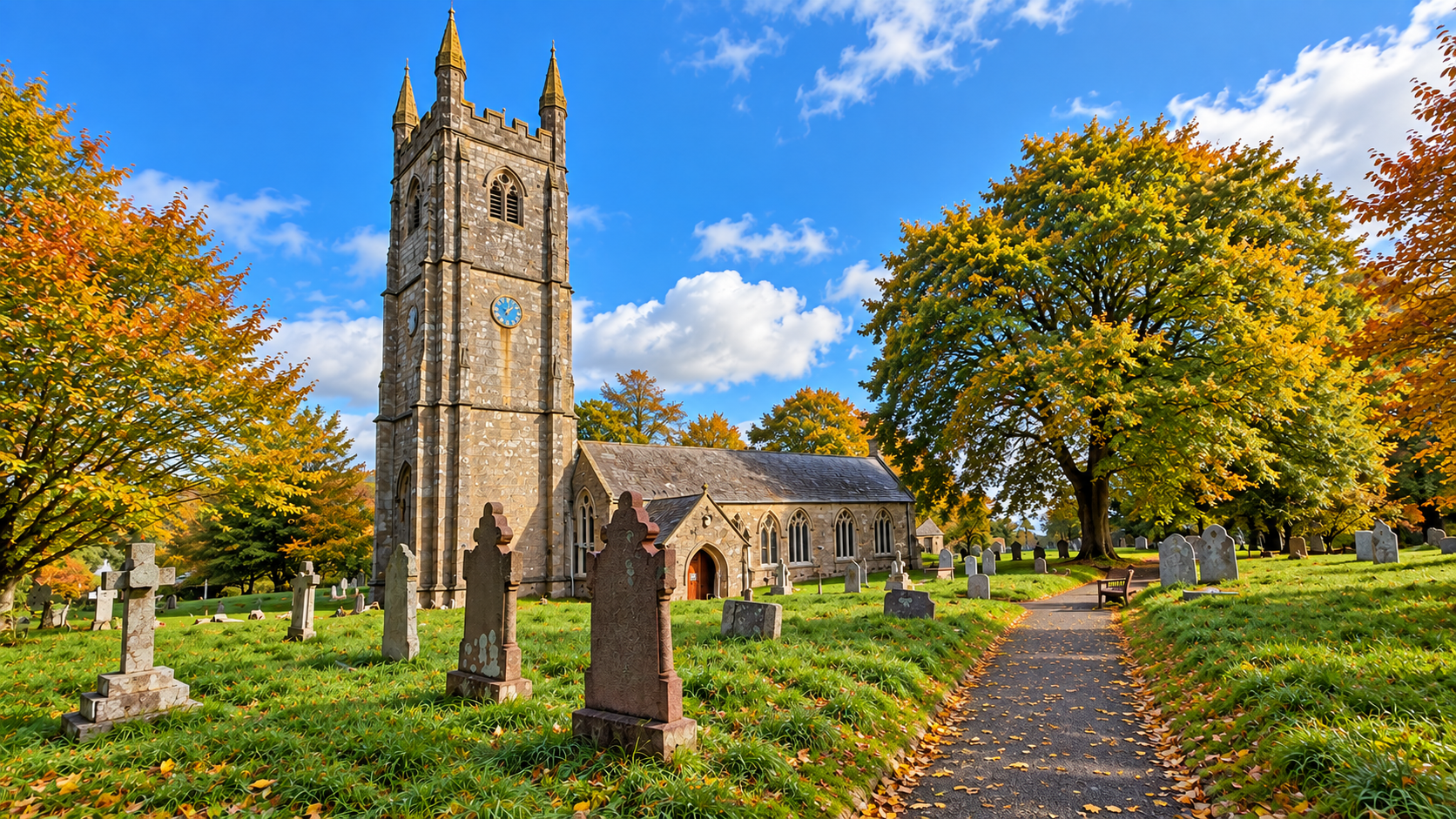
The parish church is dedicated to St Clarus and is a Grade I listed building. It has Norman origins, but most of the present structure belongs to a major rebuilding in the fifteenth century. The nave and north aisle are largely early fifteenth-century; the south aisle, porch and imposing west tower followed later in that century. The tower, about 97 feet high, is built of carefully dressed granite and makes the church conspicuous across the surrounding country.
The church was granted to the Knights Hospitaller in 1239, and its enlargement is associated with their long involvement in the parish. The medieval building was subsequently altered and restored, notably in the nineteenth century. Thus the church is not the product of a single building campaign: its fabric preserves successive periods of worship and investment.
Carradon Hill
South Caradon Mine developed after the discovery of a rich copper lode in 1836 and became one of Cornwall's most productive nineteenth-century copper mines. Mining spread across the Caradon district, bringing engine houses, tramways, workers and associated settlements. The district's prosperity was closely tied to world copper prices and eventually declined as ore became harder to win and overseas competition increased. South Caradon ceased work in 1885.
The transmitter marks a second transformation of the hill. The Independent Television Authority opened Caradon Hill in 1961 to broadcast Westward Television on the 405-line black-and-white system, extending ITV coverage into Cornwall. From 1969 the station also carried UHF colour services, including BBC television. The older VHF service remained alongside the new system until the mid-1980s; subsequent decades brought commercial radio, digital television and other telecommunications. The conspicuous mast is thus part of a long sequence of broadcasting expansion, not simply a relic of television's first popularity in the 1950s.
The parish Millennium Map
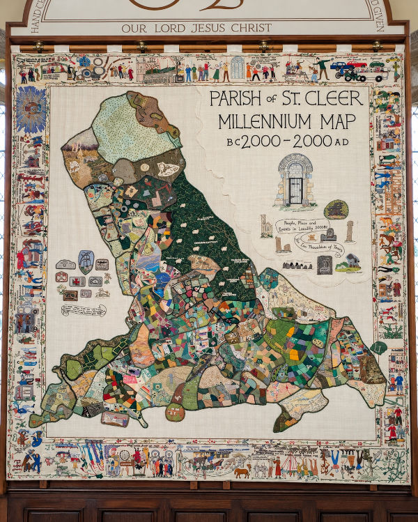
The Parish of St Cleer Millennium Map, marked “BC 2000–2000 AD”, is a remarkable piece of local collective memory. Rather than offering a conventional road map, it combines the outline of the parish with hundreds of small pictures, symbols and stitched scenes. Its borders carry people, occupations, buildings, transport and episodes from local life.
Created to mark the millennium, it sets the parish’s long past beside the experiences of its more recent inhabitants. The result is both an artwork and a community’s attempt to record what it considers worth remembering. Individual scenes would repay closer study with the makers’ accompanying notes, if available.
Inside St Cleer church
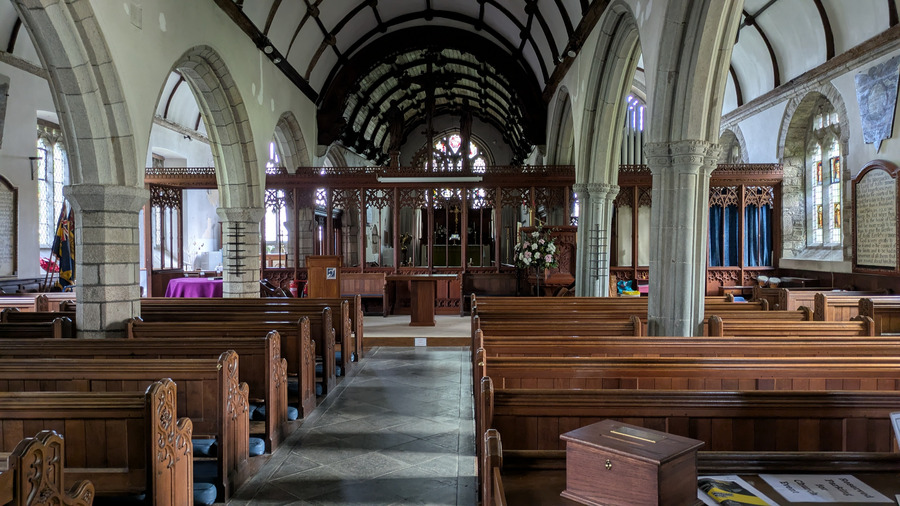
Inside, the five-bay arcades reveal the fifteenth-century enlargement more clearly than the exterior does. The north arcade has octagonal granite piers, while the south arcade uses blue elvan stone. Above them survive medieval wagon roofs with moulded ribs and carved bosses. The differing stonework makes the successive building phases visible to anyone who looks closely.
The furnishings add further layers: a medieval font, later pews and screens, early-eighteenth-century painted texts, and memorials to generations of parishioners. Historic England also records a sixteenth-century set of stocks and a nineteenth-century plough inside the church—objects connecting parish worship with everyday social life.
An unusual altar frontal
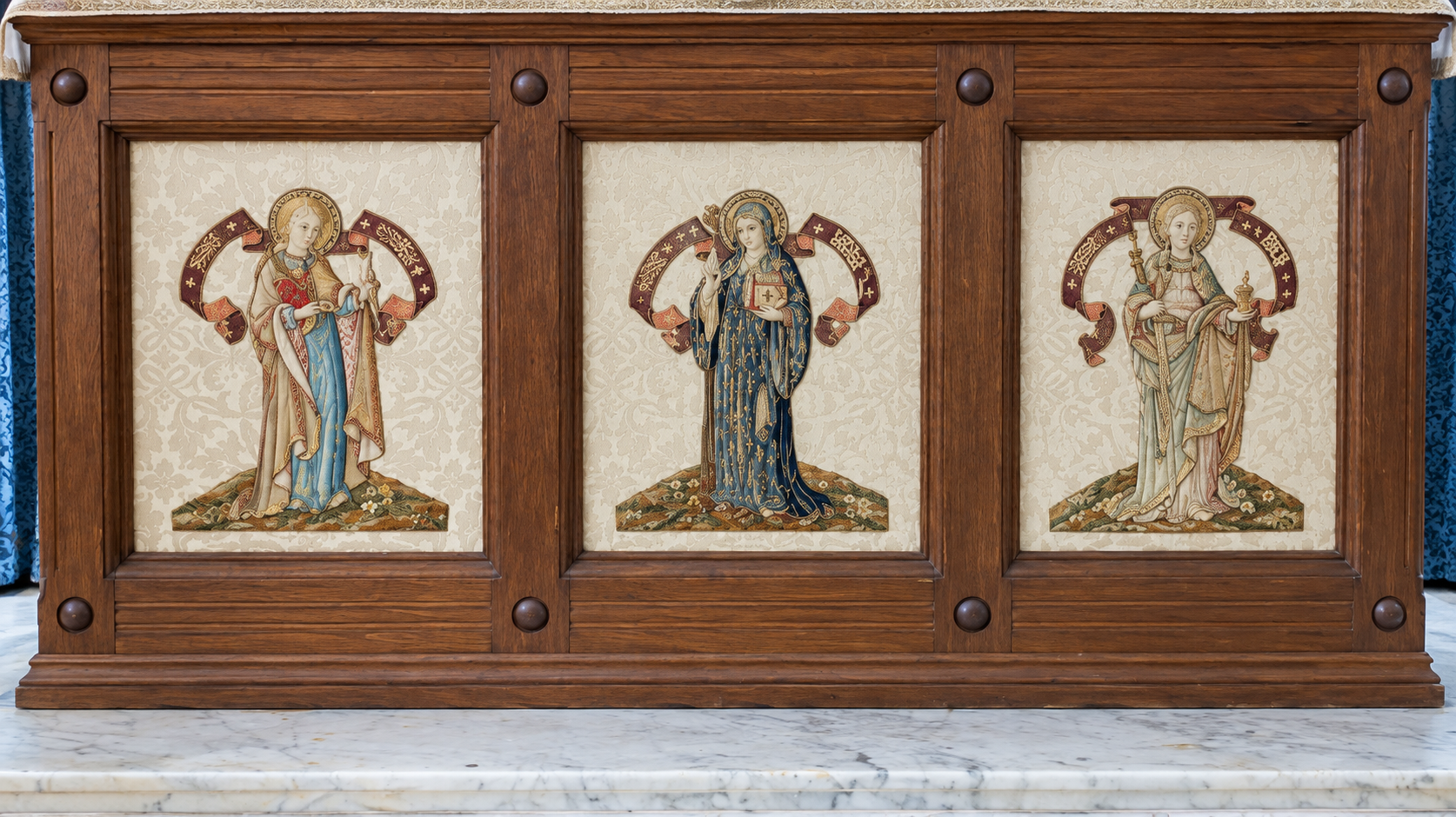
The three embroidered figures are not simply an eccentric piece of church decoration. The Cornwall Historic Churches Trust attributes the altar front, together with the reredos and screens, to the 1904 restoration directed by the architect G. H. Fellowes Prynne. The frontal therefore belongs to the early twentieth-century revival of richly furnished Anglican worship, rather than being an unidentified medieval survival.
Fellowes Prynne worked in the Gothic Revival tradition, which sought to recover the colour, symbolism and craftsmanship of medieval churches. At St Cleer the three figures are presented separately, like a small triptych, making the frontal unusually pictorial. The published account establishes the date and architectural attribution of the altar front, but does not identify the individual embroiderer or workshop; nor does it securely name the three figures. These details should not be invented.
Faith, Charity and Hope
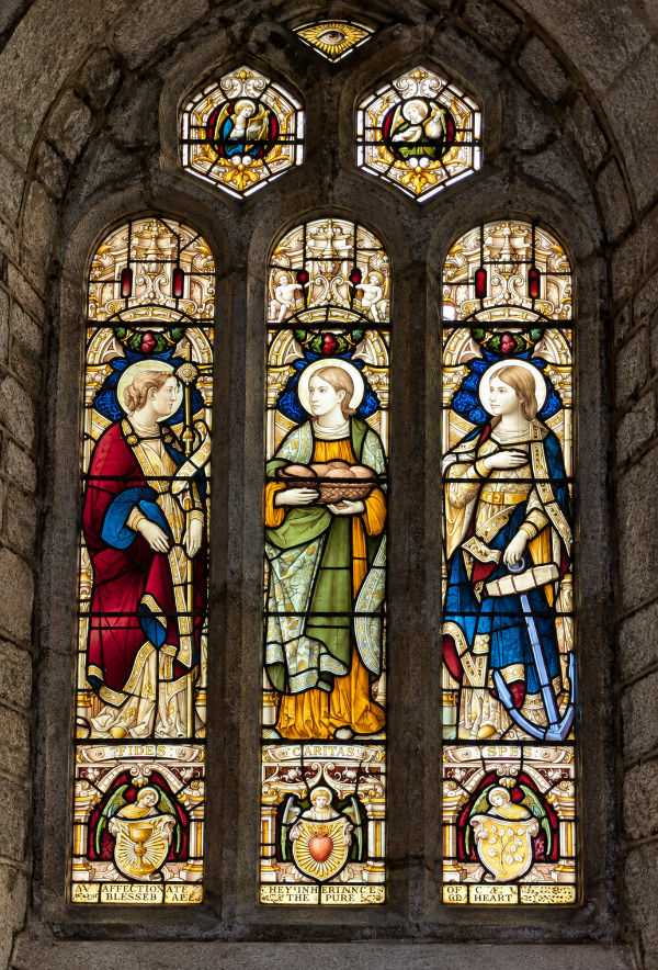
The window's maker and installation date have not yet been verified. Its style alone is insufficient evidence for either, and neither should be presented as established fact. A parish guide, faculty record or stained-glass inventory may provide the attribution.
The three main lights personify the theological virtues named beneath them: Fides (Faith), Caritas (Charity or Love) and Spes (Hope). These virtues derive from Christian teaching, notably Paul’s first letter to the Corinthians (13:13), where faith, hope and love are named together.
The symbolism is carefully differentiated. Faith carries a cross; Charity holds a basket of loaves, representing practical care for others; and Hope holds an anchor, a traditional Christian emblem of steadfast expectation. The window presents moral qualities as figures whose gestures and objects make abstract ideas visible.
The Ringers’ Articles and a biblical text
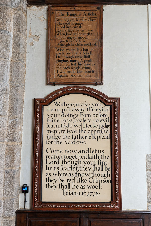
There are not merely five painted biblical panels in the church. Historic England records five rectangular framed texts dating to about 1708 and a further thirteen early-eighteenth-century texts painted as illusionistic ovals: eighteen in all. The Ringers' Articles are a separate board, probably early nineteenth-century. The larger board below the Articles belongs to the tradition of making scripture prominent in the post-Reformation parish church.
The upper board is headed “The Ringers Articles”. Its rhyming rules warn bell-ringers against ringing to celebrate a death, quarrelling, swearing and careless conduct. One verse declares that whoever swears, curses or strikes another in anger—even without drawing blood—will incur a penalty. Another warns that a ringer who wears his hat, turns a bell badly or rings unskilfully must forfeit sixpence for each offence.
This board is evidence of a once influential parish fraternity. From the seventeenth century, change-ringing developed into a skilled collective activity, and ringing companies often acquired their own customs, officers, funds and disciplinary rules. Their command of the bells gave them a conspicuous role in the soundscape of the parish: bells announced worship and marked weddings, public celebrations and moments of alarm. In some places ringing groups became remarkably independent of the clergy, defending their privileges and controlling admission to the tower. Nineteenth-century church reformers sought to bring them more firmly under clerical supervision.
St Cleer’s rules, with sixpenny penalties for misconduct or poor ringing, belong to this wider history of corporate pride and self-regulation. They do not prove that the St Cleer ringers exercised powers beyond the tower, but they show that the group took its discipline seriously. Historic England dates the painted Articles board probably to the early nineteenth century. The parish had four bells recorded in 1551, later increased to six. An 1870s account of a ringing competition at Liskeard even names members of the St Cleer team, giving a glimpse of the ringers’ wider social network.
The larger painted board below is more than a decorative Bible quotation. It reproduces Isaiah 1:16–18, calling on people to stop wrongdoing, practise justice, defend the fatherless and plead for the widow. Historic England records five framed painted biblical texts in the church dating to about 1708. Their survival is a particularly interesting reminder of the post-Reformation practice of teaching through prominently displayed scripture.
St Cleer Holy Well and Cross
A useful comparison is Dupath Well near Callington, another surviving Cornish granite well-house. Dupath was probably built about 1510 by the Augustinian canons of St Germans and is a more enclosed, chapel-like structure with a steep stone roof and bell turret. The contrast helps explain what makes St Cleer's open-arched construction so unusual: both enshrine a spring, but their architectural solutions are strikingly different.
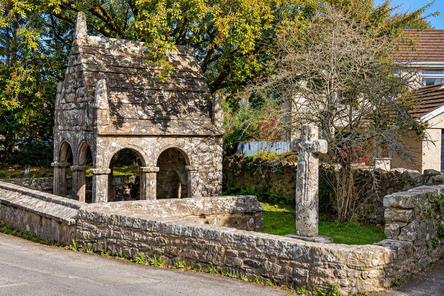
St Cleer’s Holy Well is one of the most remarkable surviving medieval well-houses in Cornwall. The open, porch-like granite structure dates from the late fifteenth century and is unusual for its arches, decorated capitals and vaulted stone roof. Historic England describes it as the only surviving Cornish well-house with this open porch-like design.
The well was already ruinous when antiquarians recorded it in the nineteenth century. Henry Rogers of Penrose had it restored in 1864 in memory of his grandfather John Jope, a former vicar of St Cleer. The neighbouring stone cross is believed to be contemporary with the medieval well-house. Tradition credited the water with healing powers; it may once have been used for ritual immersion, though that interpretation remains uncertain.
Trethevy Quoit
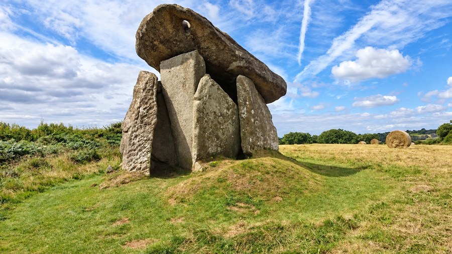
Trethevy Quoit takes the ride back far beyond the Christian and medieval monuments. It is a Neolithic portal dolmen, generally dated to about 3500–2500 BC: a chamber built from massive upright slabs and covered by a huge capstone. Its structure survives unusually well and rises to about 2.7 metres.
The monument is usually described as a tomb, but English Heritage cautions that burial and ceremonial functions may have overlapped. It is among the most striking physical remains of Cornwall’s early farming communities and provides a fitting end to a ride crossing several thousand years of history.
Historical sources and further reading
The principal historical descriptions and dates were checked against the following records. Local legends are identified as traditions rather than established events.
- Historic England — Church of St Clarus
- Historic England — King Doniert’s Stone
- English Heritage — History of King Doniert’s Stone
- Historic England — St Cleer’s Well and Cross
- Historic England — Trethevy Quoit
- English Heritage — History of Trethevy Quoit
- Cornwall Online Parish Clerks — St Cleer parish history
- Historic England: Treverbyn Mill
- Historic England: Church of St Clarus
- English Heritage: Dupath Well
- Cornwall Heritage Trust: Tregeagle
- UK Centre for Ecology & Hydrology — Dozmary Pool depth and characteristics
- Environment Agency — Dozmary Pool monitoring and chemical classifications
- Cornwall Historic Churches Trust: St Cleer
- History of bellringing and Victorian reform